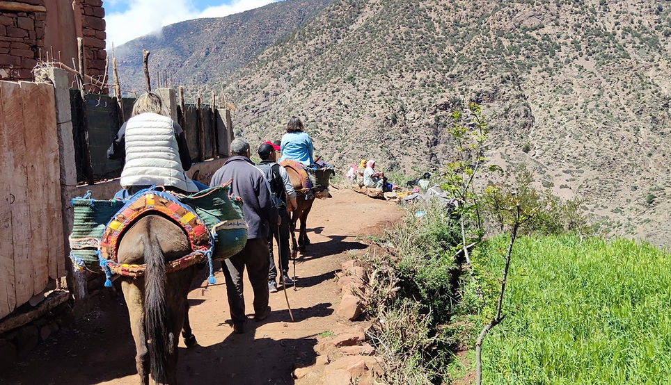
Mule Ride
From Tazitounte to Tizi N'oucheg
Program and price
2 people: 2,640.00 Dhs (1,320.00 Dhs / person)
3 people: 3,240.00 Dhs (1,080.00 Dhs / person)
4 people: 3,860.00 Dhs (965.00 Dhs / person)
Daytime
Easy level
Available all year round


8:30 a.m.: Departure from the Riad in a private vehicle with driver
Arrival in Tazzitounte (1400m) and departure to Acheg (traditional Berber village) and enjoy the landscapes of the mountain range
Lunch (traditional homemade meal, with fresh, local produce)
Visit the village of TiZi Noucheg and return to the starting point
Return to the riad with panoramic stops for taking photos

A little of history
-
Tizi N'oucheg is a Berber village located at an altitude of approximately 1,600 meters, in the heart of a narrow valley in the High Atlas Mountains.
-
The area surrounding the village is part of the Aït Oucheg region, in the Ourika Valley.
-
This area has a strong tradition of mule tracks, trails connecting villages, farmland, watering holes, and pastures (transhumance areas) according to the seasons. These trails were essential to the mountain lifestyle, long before the advent of motorable roads. (This is a mountain generality, but very likely for the route between Tazzitounte and Tizi N'oucheg.)
-
Historically, villages like Tizi N'oucheg relied heavily on subsistence farming, livestock rearing, seasonal grazing, and local solidarity (mutual aid, cooperation) to access resources (water, wood, pastures).
-
Collective organization plays a long-standing role: the sharing of irrigation water, pastoral commons (agdal), etc. These traditional institutions have managed resources over time, travel routes, and pastures.
-
Practical function: The path between Tazzitounte and Tizi N'oucheg (and similar paths) served to connect villages with each other or with grazing plateaus, to transport water, wood, and fodder, to exchange goods, and to reach markets or other villages. Mule drivers (and mules) played a central role in transportation, partly because passable roads were few or nonexistent.
-
Cultural and social connecting paths: These trails are not only utilitarian—they are also places of encounter, exchange, and sharing (between villages, between families), festivals, and seasonal rituals (transhumance, nature celebrations, etc.).
-
Modern developments: Over time, some of these trails have been gradually replaced or supplemented by tracks and small roads (or even improvements to existing ones), but many retain their pedestrian or mule-trail use, particularly for tourism or walking. In Tizi N'oucheg, hiking and walking tourism have become a source of income and a means of promoting local heritage.
-
The village suffered a significant rural exodus during the 20th century, with residents leaving for Marrakech or elsewhere in search of work.
-
Since 2011, the Tizi N'Oucheg Development Association (ATND), led by residents like Rachid El Mandili, has implemented projects to improve drinking water, electricity, schools, and sanitation, and to make the village more self-sufficient.
-
The route (paths, access) is important in this context: to transport materials, to allow access for visitors, for connections between villages, for crops, for pastures - all elements on which the ATND has worked. Tourism and walks are part of the income-generating activities, so maintaining and promoting these trails (like the one from Tazzitounte ↔ Tizi N'oucheg) is strategic.